Quick: when you think about the best gps navigation aps, you probably think first of the Maps app or Google Maps. It gets updated regularly, is the one that most people recommend, and is generally a favorite. But if you don't like it or just want to try out something new to get you places, you do have a number of different options. Have a look through our list of the best navigation apps for iPhone.
The best iPhone apps for navigation
14 Jun 2021, by Cherry Mae Torrevillas
MapQuest iPhone app helps you get where you need to go with turn-by-turn GPS navigation. This iPhone navigation app has the tools you need to navigate the US and Canada, whether it's voice navigation for walking or driving, or exploring places of interest on a map.
- Real-time traffic updates to help you find alternate ways to your destination
- Live traffic cameras to help you plan a safer drive
- Routes designed to help save you time, gas and money
- A speedometer so you compare your current speed to the speed limit along your route
- Favorites so you can store locations, like your home and work addresses, for quick-and-easy maps and directions
- Route choices so you have more suggestions to get where you need to go faster
VZ navigator for iPhone is a premium navigation application that provides the most complete, accurate, and easy-to-use navigation assistance available. Enhanced 3D maps, intuitive local search and natural turn-by-turn voice guidance get you to your destination quickly and efficiently. Advanced features such as Doppler weather radar, gas prices, and movie showtimes give you valuable information to help save time and money.
- Simple and Adaptive Maps
- High-fidelity landmarks and transparent 3D buildings
- Real-time traffic, satellite view, Doppler weather radar and favorites
- Personalized Local Searches with choosing local places to visit is a snap
- Streamlined Navigation helping you confidently and safely maneuver around streets and highways
- Visual & Voice Lane Guidance and Realistic Highway Signs
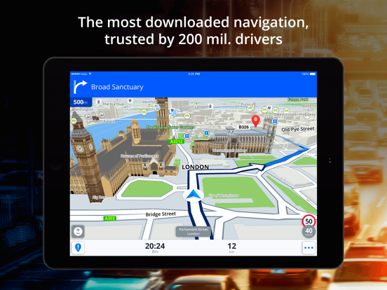
This app has a lot of smart navigation features, beautiful 3D offline maps and an easy to use interface. You can drive in unfamiliar territories easier, park with parking place suggestions and have access to live info about prices and availability, whilst avoiding speeding tickets with Speed camera warnings. Free test drive with all features is available for the first 7 days.
Sygic GPS Navigation app review: never get lost again
- Offline maps of all countries in the world, from TomTom and other providers that has free updates multiple times per year
- Voice-guided GPS navigation with precise directions and spoken street name
- Avoid traffic jams with the real-time traffic information with data collected from more than 500 million users worldwide
- Apple CarPlay Connectivity - all navigation features on your car’s built-in display (add-on feature)
Waze is a community-based traffic and navigation app you can use to save time and gas money while making your drive to work better. When you drive with the app open, it will add lots of real-time info. You can actively report police checks and traps, accidents, construction, and other issues along the way. You can use turn-by-turn voice navigation, see friends' ETA when you're going to the same destination, and it only takes one tap to show the way to Facebook and Calendar events. You can find the least expensive gas station on your route, get automatic re-routing if conditions are bad on the planned road, and you'll earn points as you contribute and climb the ranks.
Waze app review: A GPS navigation and social traffic sharing tool
- Community-reported alerts
- Live maps
- Add info on local businesses and places
- Save gas money and time
- Free navigation app for iPhone
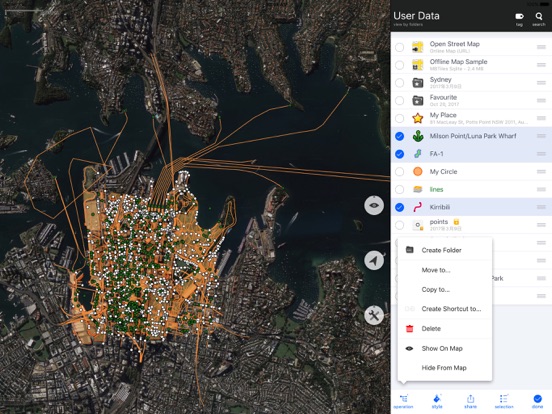
Map Plus is a powerful app that allows you to view and edit custom maps. You can use the app as a pro GIS tool to help you plan trips, outdoor sports adventures, and more. Gather data, edit, measure, view online or offline, share, and plan using this app. You get the option to customize dozens of online and offline maps, you can download maps from any online map provider, and you will get street views for most cities around the world. You can bulk apply tags, custom properties, and tags to all selected items using custom Feature Class, you can use Finger Drag editing, and you can share via several options.
Map Plus app review: superior tool for viewing and editing custom maps
- Common map features
- Customize online and offline maps
- Import and export data
- Finger-drag editing
- Free with in-app purchases
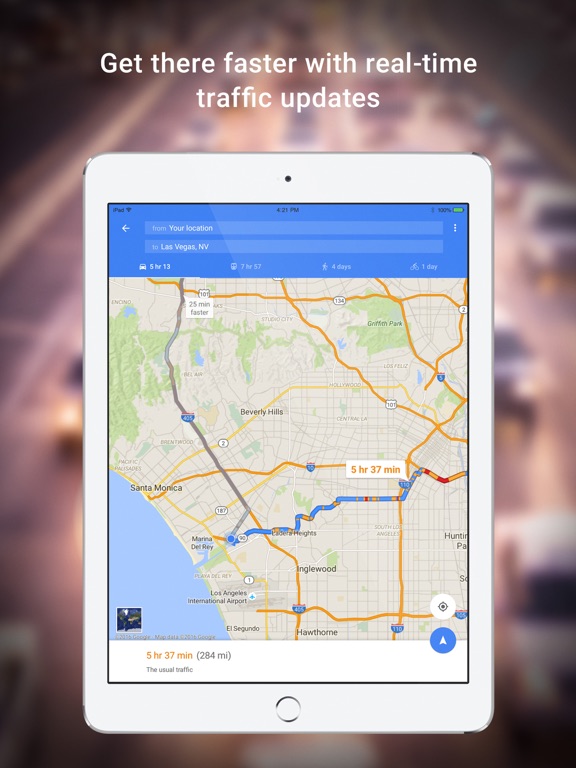
Google Maps is the one you're probably most familiar with in this list. It makes it easy to navigate anywhere you go with real-time traffic updates, transit information, pit stop data, and automatic re-routing based on incidents, road closures, and live traffic. Lane guidance will make sure you never miss a turn. You can use the app to find top-rated businesses and restaurants, plan visits, view menus, read reviews, make reservations, and save the places you want to visit. You can download maps to view them offline, use the indoor maps feature to find your way around in big places, see transit schedules for more than 15,000 cities, and view accurate maps in 220 countries and territories.
Google Maps app review: back and better than ever
- Get there faster
- Transit maps and schedules
- Discover places
- Street view and indoor imagery
- Save common routes
Route4Me is great for personal and business purposes. It accurately provides users with the optimal routes. Start by adding all of the stops to your route. Then hit the Plan Route button. After that, the app will automatically plan out your best route and you will be able to. It also reorganizes your route if you complete a stop and a more optimal route can be created. Save time and money by using this handy app. If desired, you can share your routes with other friends and coworkers. There are in-app purchases for subscription service options.
- Route planner for work or personal needs
- Enter all stops along the route
- Automatically get optimized route
- View route on map, Share route with others
- In-app purchases for subscription options
inRoute is a route-planning app that will automatically check your route for severe weather as you drive, help you plan the best route between locations, and chart your own course based on curviness, weather, daylight, elevation, and more. Some of the features include voice guided navigation of up to 100 locations, custom routes, interactive charts, and easily reordered waypoints. You can save your favorite places and routes, search along a route, export routes, and set layover and departure times. Other features include the ability to organize into folders, sync between devices, share with friends and family, and print via Airprint.
inRoute app review: a trip planning tool-2020
- Route-planning app
- Set layover and departure times
- Show alternates for each leg of a route
- Save your favorite places and routes
- Free with in-app purchases
HERE Maps will help you get where you're going wherever you are in the world. Plan your journey beforehand and save a map of your destination on your iPhone. This way, you can use it even when you're offline. The app offers maps for over 100 countries all over the world. Use the route planner that shows you public transit, walking, and driving options so you can make the best decision for your outing. You get turn-by-turn voice-guided driving and walking navigation, public transit maps, syncing among devices, maps you can save and use offline, and real-time traffic and incident info for over 40 countries.
- Save and use maps offline
- Maps for over 100 countries
- Route planner
- Turn-by-turn voice-guided walking and driving navigation
- Free navigation apps for iPhone
GPS Tracks lets you navigate to waypoints, store your favorite destinations, and track your outdoor activities. Use it for your hiking, biking, walking, running routes. The app works well for fishermen and hunters who want to store certain locations, and is also useful in military navigational applications. Map measure tools let you measure distance and area on the map by dropping a pin. Take GPS static observations to average current location, and use degrees or mils for the compass. You can email exported files or import or export to Dropbox, iTunes, or iCloud.
- Send locations to different apps for driving directions
- Share your location with friends via email or text message
- Post track stats to Twitter and Facebook
- View and track Glide Ratio
- Store favorite locations
Roadtrippers will be your travel companion for anywhere in the United States. Use the app to plan your next trip across the country, long weekend, or Spring Break vacation. You will learn about the best scenic spots, hotels, diners, attractions, and more with the points of interest found in the app - over a million of them! Features include the ability to book hotels and other places to stay from within the app, save maps and places for offline access, and plan complete trip itineraries. It is easy to save your favorite places and sync them among devices.
- View place details like descriptions, photos, addresses, ratings, and more
- Save trips, maps, and places for syncing and offline access
- Find amazing places you won't see in other apps
- Navigate by connecting to your fave navigation app
- Free navigation app for iPhone
The ViaMichelin app offers several different features like GPS, speed cam, traffic, and route planner. You get Michelin maps, GPS with voice guidance and community incident alerts, routes with real-time traffic, and more. The routes proposed have numerous options and travel costs so you can decide which route to take, you can customize your journey through Route Options, and you can check the ROADMAP featuring every stage of your journey. You'll see alerts for real-time traffic incidents as well as hazardous zones and the simple and accurate voice guidance will get you where you're going, quickly and safely.
ViaMichelin Mobile for iPad app review
- Real-time traffic and community alerts
- Customize your journey
- See alerts
- Simplified ergonomics
- Multiple routes available
Check out Scout and forget about that dated and tired Google Maps app. Powered by OpenStreetMap, Scout offers loads of functionality along with the most current maps available. Part navi system and part social media network, Scout lets you coordinate, navigate, and chat with your peeps all in one smooth application. Plan a get-together at a new place, share your ETA, find the best route, and get traffic alerts. The app keeps safety in mind by featuring a voice chat option so you can always keep your eyes on the road. Create a custom Meet Up and send it to your buddies; you can even keep track of where they are and when they’re likely to arrive.
Scout Personalized GPS app review
- Coordinate navigation with groups
- Voice chat
- Share ETA
- Avoid traffic
- See where your friends are


