How many times have you found yourself wandering around or driving around completely lost in unfamiliar surroundings, wasting time and getting frustrated in the process? The truth is that we could all benefit from a map now and then whether you’re traveling or you’re in your hometown. We can’t always know the best route, the quickest route, or even exactly where we want to go, which is why the following map-based apps can come in pretty handy.
The best iPhone apps for maps
31 Mar 2021, by Cherry Mae Torrevillas
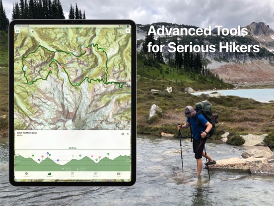
This iPhone app for maps is designed and tested on real dirt by outdoor enthusiasts. Topo Maps app+ is packed with good planning tools, trustworthy maps, on-trail tools, and tips to enhance YOUR navigational mindset. Topo Maps+ has the complete feature set to plan, execute, and remember your trip…all while keeping you safe in the backcountry.
- Compare and Download maps for use offline.
- Combine overlays to customize your map view
- Smart route-building tools
- Print, email or share custom maps and routes
- Public, Private, and Hunting land boundaries
Avenza Maps is a powerful offline map viewer with a connected in-app Map Store to find, purchase, and download professionally created maps for a wide variety of uses including hiking, cycling, camping, outdoor recreation, and adventure traveling. Free for recreational use, just pay for maps or download free ones. A subscription is required for professional users. The mobile maps don't need the internet to work.
- Locate and show GPS position and compass direction
- Record GPS tracks during your activities
- Drop placemarks wherever you are and add notes or photos
- Measure distances and areas
- Overlay search engine results on any map for offline use
- Use built-in recreational symbols or import your own
- Access to almost one million maps in the Avenza Map Store in-app and online
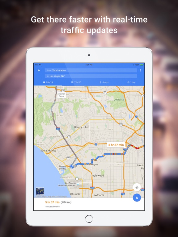
Google Maps is, of course, the go-to of map apps for many people. When Apple’s Maps app came out, of course, it totally sucked but they had removed Google Maps from being a loaded app so everyone had to install it if they wanted to get where they were going. Google Maps offers many features like real-time updates, reviews and ratings, the option to save places you visit a lot, and much more. You have access to transit schedules and maps for thousands of cities, indoor maps for large venues, offline maps, Street View, and more.
- Real-time ETAs and traffic conditions
- Lane guidance
- Discover and explore
- Offline maps
- Free map app for iPhone
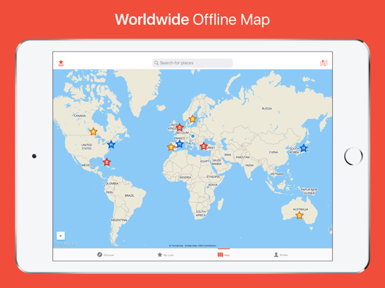
CitiMaps2Go gives you the chance to save locations, plan out your trips, whether online or offline. You get features like the ability to find attractions, travel inspiration, saved locations and lists, addresses of friends, and more. You don’t have to have data so it will save your worry when you’re out in the boonies and don’t have a signal. The app has maps for over 150 countries, 15,000 destinations, and 50 million places. The maps are clear and concise, you can share with friends, search specific places by name or browse by category, and you can create a user account and log in from any device to see your saved locations.
City Maps 2Go Lite for iPad app review
- Find attractions
- Get travel inspiration
- Save locations
- Maps of over 150 countries
- Free with in-app purchases
This free maps app is very fast, highly detailed and completely offline. The developers of this app stress that the maps and app itself will always remain free, which we absolutely love. This app has maps that are available worldwide and are constantly updated. Get directions to points of interest, use the navigation feature for turn-by-turn directions, bookmark your favorite locations, share locations with friends and more. This app also allows you to book hotels, find places to eat or shop at, look for tourist attractions and find the nearest public transit.
- Free map app that’s available offline
- Highly detailed maps, Always updated
- Maps from around the world, Save locations
- Share locations, Turn-by-turn directions
- Find places to visit, eat or shop at, Book hotels
Roadtrippers is a map app that was designed specifically for travellers. Use it to plan your road trips, or just explore the areas around you. You’ll discover new places like cool places to eat, scenic views, fun little roadside attractions, hotels, and national parks. Plan your trips from within the app or the website, and share with a group. Your friends can add notes to your itinerary and use their fave navigation app for iPhone. Any trips you save automatically sync across devices. As of right now, the content is US-only. The app is also compatible with Apple Watch.
- Made especially for travellers
- Plan your road trips or explore the world around you
- Discover new and interesting places
- Share with a group
- Free iPhone app for maps
Maps of our World is a geography quiz that tests how well you know the world, and also makes it fun to learn. Do you know where the Himalayas are? How about the Andes? Could you find Egypt on a world map? Learn the capitals of countries, rivers, whatever you want. The app has well-designed, beautiful maps that makes it fun for both kids and adults to learn geography. The easy levels are easy, but definitely increase in difficulty as you go. There are seven political maps available immediately and maps for Switzerland, Germany, United Staes, and United Kingdom can be unlocked. All maps in physical version can be unlocked.
- Test your geography knowledge
- Learn about different countries as well as your own
- Starts off easy and gets more difficult
- Seven political maps available immediately
- Free with in-app purchases
HERE Maps helps you find your way so you can explore without fear of getting lost. You’ll always know where you’re going, even if you’ve never been there before, with this app. Plan out your adventure ahead of time and save a map of your destination on your iPhone. There are maps for over 100 countries that you can access even when offline. The route planner shows you public transit, driving, and walking options, too. You get voice-guided turn-by-turn navigation, public transit maps, a route planner, offline maps, real-time traffic info, and saved places are available on all your devices.
- Turn-by-turn navigation
- Save maps for offline use
- Sync across devices
- Maps for over 100 countries
- Free map app for iPhone
If traffic is something you deal with on a regular basis then you could really benefit from the Waze Social GPS, Maps & Traffic app. Not only will you be able to get accurate directions but you can access information that will save you time getting to your destination, which will also mean money saved on gas. The app provides users with voice-guided directions that are on a turn-by-turn basis, and you'll get real-time traffic information, and live routing. Additionally you can access such information as where to find the cheapest gas on your route, live maps, you can share your ETA with contacts and view theirs, and the app is able to automatically re-route you.
- Use the app to get accurate directions which are given in a turn-by-turn basis
- The app is able to automatically re-route you and routing information is live
- Get real-time traffic and road information
- Share your ETA with family and friends and view theirs
- Find out where the cheapest gas is on your route
Meeting up with friends and family has never been easier or more streamlined thanks to the Scout GPS Maps. Unlike some navigation maps that have the goal of providing routing information this app has been designed to make meeting up with people simple. Through this app you'll be able to create plans with your friends, talk with them, and then meet with them with help from the tools offered. As you are on route to meet up you'll get turn-by-turn information and you can check out real-time ETA information for each of your party so you know exactly when everyone should reach the destination.
Scout Personalized GPS app review
- The app makes it possible to create plans with friends where you plan a meeting spot
- You’ll get turn-by-turn navigational information
- View the real-time location of all the other members in your party
- You can chat with your friends right through the app
- Use the app to find the closest, most cost-effective parking area to your meeting spot
Just because you don't have an Internet connection doesn't mean you should sacrifice what maps you have available to you and that's where the Map Plus app can prove to be quite useful. Through this app users will have access to a variety of offline and online maps from sources like Open Cycle and Google map. There is a route navigator you can use when you are abroad, if you hike or bike often there is the GPS tracker and recorder, you can make notes, take photos, and use geometry data in your travels, and the app can export and import a variety of content.
- Users can take advantage of a full feature mapping offering
- Many of the maps are available offline
- There is a GPS tracker and recorder that is ideal when you bike or hike
- The app can be used abroad
- Make notes on maps, add photos, and use geometry data
Because you don't always have an Internet connection but still need to be able to access accurate and handy navigational information there is the Galileo Offline Maps app. This app provides you with maps of many regions/countries so you can use it at home and abroad. The content is updated monthly so that users can depend upon it and it supports a variety of languages. The offline search tool can be especially handy and lets you search by a variety of parameters which are GPS coordinates, category, or object name.
Galileo Offline Maps app review
- The app provides users with a wide variety of offline maps that are updated monthly
- Use this one at home or abroad
- There is an offline search tool that lets users search by GPS coordinates, category, or object name
- The app supports a variety of languages
- There are additional tools such as Geodata, GPS recording, being able to back up your data, and much more


