Have you ever wanted to measure distances and areas using a map? It's a lot easier to do when you use a distance measuring app on your device to check the distance between two points or monitor the distance traveled between locations. You'll be able to measure the sizes of buildings, draw a path and then measure the distance, and other cool functions using these apps. Check out our list of the best apps to measure distance for the iPhone and iPad.
The best measurement apps for iPhone and iPad
5 Jun 2021, by Christine Pamintuan
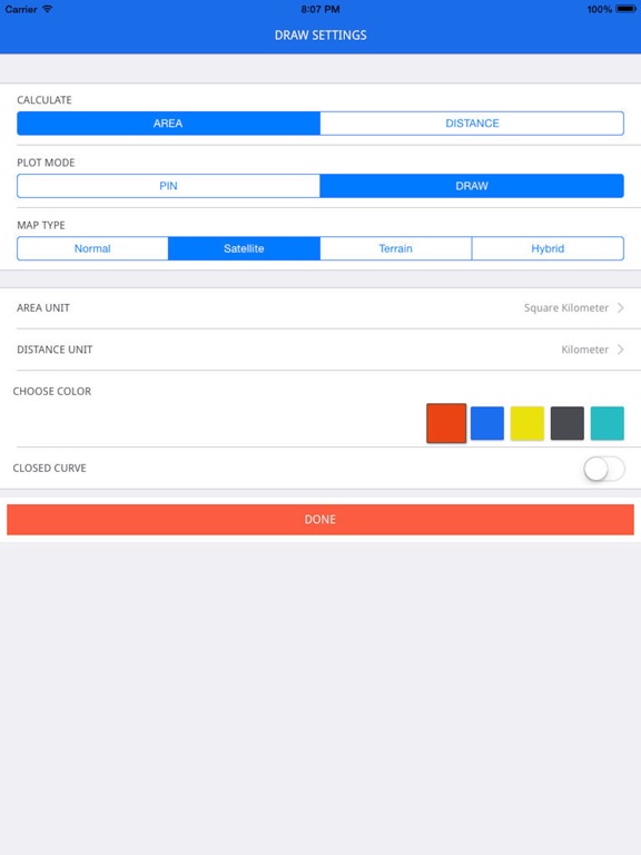
The measurement app for iPhone allows to Measure Map Area and Distance on Google Maps ™ and Apple Maps. With the Mapulator app you can do a lot including calculating the area of a land or city and the distance of aerial routes. The app is very useful for civil engineering works, has high performance and accurate measurements and very intuitive user interface. It can be used for planning your trek/hiking routes and in civil engineering.
- Measure using Pin, Circle or Drawing options.
- Pick stroke and fill color.
- Select different metric units.
- Live Drawing : Calculate as you draw.
- Search location using address or zip code or city.
The heat index, also known as the apparent temperature, is what the temperature feels like to the human body when relative humidity is combined with the air temperature This air temperature app is designed to calculate Heat Index. You only need to enter Air Temperature and Relative Humidity; the rest is yours. Most people are quite comfortable when the index is below 70 and very uncomfortable when the index is above 80 to 85.
- Be aware of the current heat index, stay safe and comfortable
- Supports different temperature units: Kelvin, Celsius (° C), Fahrenheit (° F)
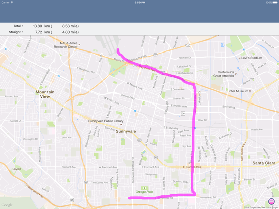
Distance Measurement allows you to trace on your iPhone or iPad with your finger and the app will measure the distance you traced. Units are in both kilometer and mile. You can zoom in to get a better view of the map and accurately trace your exact past or future route to see exactly how far it is. It is easy to search locations to find the area you want to measure, and the maps look and work very similarly to the original Google Maps concept. The app is very simple and has a basic user interface so it's very intuitive and easy to use.
- Trace a route with your finger
- App will measure the path drawn
- Zoom in on the map
- Search the map for specific locations to measure
- Free distance mapping app for iPhone and iPad
This handy little app is great for whenever you need a ruler or measuring tape. It may sound silly at first, but when trying to map out a distance between objects or items in the home, measure space or any other related task, it can be very frustrating when you don’t have any measuring utilities. This app turns your iPhone into a measuring tool and does so in a very convenient manner. The app’s design is elegant and easy to see. You can measure in inches or centimeters. There are sliders to measure small objects accurately. Another great attribute is that this app doesn’t have intrusive ads blocking your measurements.
- A handy and reliable measuring tool
- Ruler, Measuring Tape, Photo measuring tool
- Elegant design, Easy to view
- Measure in inches or centimeters
- Sliders to measure small objects accurately
We like the concept behind this app. Users can draw on a map to measure the distance between locations. The process is very simple and great for users in a hurry. Just touch the map, draw a route on the map and find the distance. The magnifier will help to make your drawing more precise. Move around the map to find more routes or measurements, change display units, share results with others, search for desired location and more great features. This is a great app for iPads and larger iPhones.
- Draw on a map to measure distance
- Search for specific location or coordinates
- Tap, Draw and Measure with accuracy
- Change units of measurement, Move around the map
- Share your results with others
Planimeter Pro is map ruler tool to help you measure distance and area on maps. Anything that is visible on the satellite map can be measured, whether it is a roof, lawn, fence, swimming pool, or whatever else you see. The app will let you measure distance and area; measure as polygon, star, path, or polygon; and measure multiple areas at the same time. You can use the cross hairs to locate or find by GPS or search. The app supports multiple length and area units and you can add any units of measurement you want.
- Supports Apple's Maps app and Google Maps
- Configurable fill color
- Measure multiple areas at the same time
- Supports multiple length and area units
- Measure anything you see on the satellite map
EasyMeasure allows you to aim your device's camera at any object around you and the app will display the distance between you and the object. It has a 3D camera overlay grid so it is intuitive and easy to use. The app uses the height of the camera lens and its tilt angle to figure out the distance to the object. The app includes an in-depth animated tutorial on how to use it so you get the most accurate results. You can use it to measure the height and width of objects, share your results, and you can upgrade to analyze and adapt measurements after a photo is taken.
- Use your device's camera to measure distance to objects
- Both Imperial and Metric units
- Use your flashlight for measuring in the dark
- Calibrate your device for the most accurate results
- Free with in-app purchases
Distance Measure allows you to measure the point-to-point distance between two or more waypoints on a map. You can also measure the surface area defined by a polygon with three or more points as corners. Since the app uses online maps you must have an Internet connection to use it. To set a new waypoint just tap and hold a location on the map. To read the manual on how to use the app, tap the Options icon. You can change the map type or unit of measurement using the Info view: choose among meters/kilometers, feet/miles, and nautical miles. You can also switch to Save/Restore view. If you like this app, upgrade to the Pro version by buying the app as a separate purchase
- Measure the point-to-point distance between two or more waypoints
- Measure the surface area defined by a polygon with three or more points as corners
- Must have Internet connection
- Tap and hold to set a waypoint
- Pro version available as separate app purchase
The Area - Calculate my Area app makes it easy to measure area on a map. Just press the “+” button or press and hold the screen at the location where you want to drop a pin. Put the first on the center of the area then drop the other pins around it in a clockwise fashion. After you've placed three or more pins, the area inside those pins will be calculated by the app. Press Clear to remove all pins and lines, Locate to jump to your current location, and if you want to determine distance between two points, just place two pins on the map. For most accurate results, place pins all around the outline of the area you want to measure unless the shape of the area is simple. In this case, just put pins at the corners.
- Easy and fast to use
- Place a pin at center then pins along outline to measure area
- Measure distance between two pins
- Area is measured after three or more pins are dropped
- Free app for measuring distance and area on a map
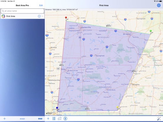
Best Area Pro allows you to easily and quickly figure out distances and areas on a map. If you have to measure things such as flat roofs, landscape, asphalt coatings, floor space, fencing, forest areas, this is the app for you. You are also able to use it to measure distances for walking or paths taken by car or bike. You get several options for entering locations, automatic recognition of areas, the ability to switch between Imperial and Metric measuring systems, and support for diverse maps. You can enter a location from an existing area, directly from the point in the map, or by typing in the address with automatic recognition.
- Figure out distances on a map
- Measure area on a map
- Several options for entering location to measure
- Switch between Imperial and Metric
- Use Navigon, TomTom, Apple Maps, Google Maps, and Waze
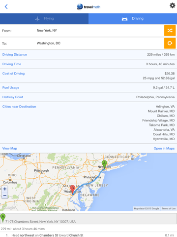
Travelmath is an app that will figure out the distance between two locations. You'll be given flight time, driving distance, where the closest airport is to your destination, the cost of driving, and more. Figure out the flight distance between airports, the driving distance between cities, the time difference and international time changes, the closest airport to any city, non-stop direct flights to your destination, and more. When you want to figure out a budget the app will calculate the fuel cost of driving and you can even see the halfway point between two cities in case you want to stop for the night.
- Figure out the distance between two locations
- See the closest airport to any city
- Find non-stop flights to your destination
- See the flight time and distance between two airports
- Free distance mapping app for iPhone and iPad
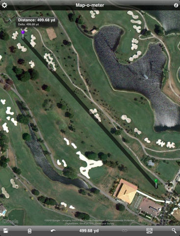
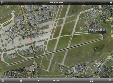
Map-o-meter is a handy distance measuring app, for anyone who wants to know exactly how far the crow flies. Just drop your pins and instantly get the distance between them. Drop more than two pins onto a location and get the area between them. The app also shows delta and heading. Users can set preferences to make calculations in metric or imperial. This app provides quick information useful to professionals in construction or surveying, as well as for any athlete interested in calculating mileage or planning workouts. Features include a search function, that will locate a known location on a map.
- Drop pins to easily and instantly get the distance between them
- Imperial or metric
- Calculate area
- Delta and heading
- Free distance mapping app for iPhone and iPad


