Once you’ve used a nautical navigation app you’ll wonder if you're chart plotter is even necessary. You might also ask yourself why your built-in plotter system and charts cost so much money when you can do the same thing with your iPhone and a quick download or two. Not all of these apps are worth your time and effort, though, so we’ve had a look for you. Here’s our list of the best iPhone apps for nautical navigation.
The best iPhone apps for nautical navigation
8 May 2021, by Cherry Mae Torrevillas
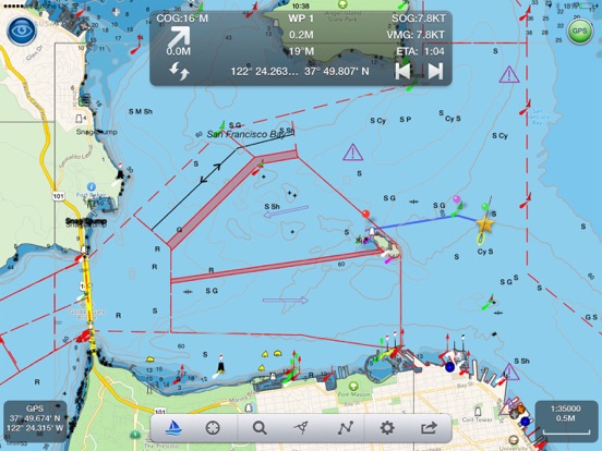
This nautical chart app for iPhone and iPad is the app to satisfy all your Fishing and Boating's needs, developed with the help of expert boaters. Download one of the best up-to-date marine navigation apps to safely enjoy the new boating season. With the Aqua Map Master transform your device in a real ChartPlotter. Below are some of many useful features of the app:
- Download the charts on the device for offline use
- Plan and navigate your Routes and Tracks with real-time information
- Anchor alarm with advanced configuration
- Tide & Current predictions and simulations (North America & Australia)
- Overlay the USACE surveys and USCG List of lights on your charts (only US)
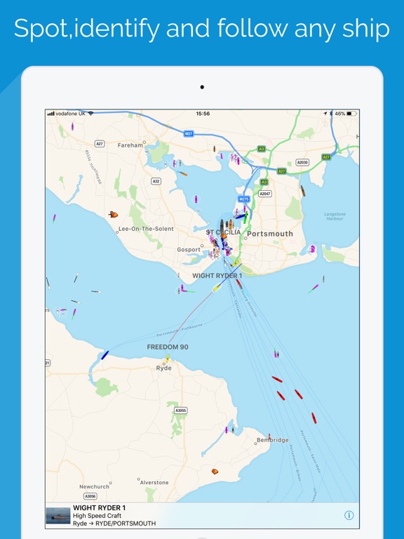
If you ever wanted to know more ships and boats, or track a vessel around the globe, then this ship tracking app for iPhone is what you need. Boat Watch, one of the best boat tracking apps for iPhone lets you spot and identify boats and ships in an instant. Boat Watch now gives you the option to buy official NOAA nautical charts for the US, so you get the same view of the ocean as the ship's navigator. See the shipping channels, buoys, lights and hazards and why a ship is taking a particular route. Boat Watch is a free app, which offers...
- Spot any boat or ship via real-time AIS network
- See the name, type and destination of each vessel
- Set any boat as a favorite, and track it on the map
- Search and find boats and places
SeaNav is a nautical navigation app for iPhone. With this sea navigation app, you are able to explore, plan and navigate your boating trips in real time and outstanding high-resolution using digital charts derived from the latest NOAA and UKHO data providing coverage across the US and Europe (US, CA, UK & IE, DE, FR, NL &BE, DK, NO and ES). Raster charts for NZ, FI and EE. The free version includes all navigation and trip planning tools. High resolution vector charts are available by In App Purchase (IAP) with free chart updates for a 12 month-period.
- Vector charts - all buoys, lights etc.
- Seamless fast panning and zoom across charts
- Route Planning and real-time tracking
- North up and course up displays
- Offline charts
- Configurable layers and a lot more other useful features
Nautical charts for cruising, fishing, sailing, diving and all your activities on the water. Get the same detailed marine and lake charts and advanced features as on the best GPS plotters. Download and get a trial for all our charts and features for a limited time.
Download chart layers for offline use and access daily updates, chart overlay and advanced features (renewable).
- NAUTICAL CHART: This accurate and thorough map of lakes and marine areas is continuously updated.
- SONARCHART!": This 1 (0.5 m) HD bathymetry map with extraordinary bottom contour detail is enhanced by millions of sonar logs contributed by boaters such as you.
- COMMUNITY EDITS and ACTIVECAPTAINÆ COMMUNITY: Join a bigger crowd!
- U.S. GOVERNMENT CHARTS (NOAA): USA, U.S. and Canada, Mexico, /Caribbean /to /Brazil, Pacific Islands, Asia and Africa.
Embark offers free navigational tools and nautical charts you’ll love to have with you on your next trip on the water. Features include the ability to instantly sync your chart and settings across all devices, you can bring your charts tie you wherever you go, you can search for anything maritime, and you can create your own chart. This app will make your boating trips more fun, more pleasant, and simpler. There are also night and sunshine charts for when it’s dark out, or really bright. Want offline charts? An in-app purchase offers more features.
- Sync your charts and settings
- Create your own routes
- Record your trips
- Save your favorite places
- Free with in-app purchases
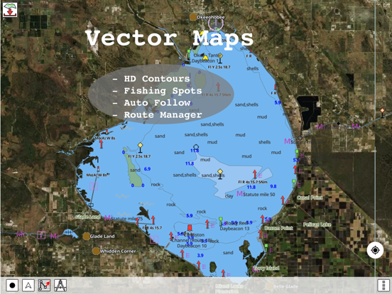
iBoating offers users access to marine charts for many countries. Features include customizable shallow depth, detailed vector charts, long-press feature to query the details of marine objects, customizable depth, voice prompts for marine navigation, auto-follow with real-time track overlay and predict path vector, tide and currents prediction, seamless chart quilting, and maps for 23 countries. You get multiple GPS features, route management and trip planning, information on tides and currents, and more.
- Route editing
- Auto-follow
- Vector maps
- Sharing options
- Free with in-app purchases
Navily is called your mobile cruising guide for a reason. If you need to find an anchoring spot, this is the app to use. You can send berth booking requests directly from the app, get information on over 2,500 anchoring spots like seabed, depth info, photos, and more. You can rank mooring fields based on atmosphere, prices, and quality, and upload photos for other members to view. You can create and manage wish lists to plan future trips, calculate ehe price for your boat at any point of the year, and easily navigate by sliding left or right.
- Provides the boating community digital tools
- Discover more than 2,500 anchoring spots
- Share your experience on mooring fields
- Request harbor berths
- Free iPhone app for nautical navigation
Whether you are going to the beach for surfing, fishing, boating or to work on your tan, this app will keep you informed on all of the latest tide information for over 9,000 tidal stations across the globe. Find tidal information based on location, view sunrise and sunset times, view 7-day forecasts, download information for offline viewing and more. This app provides a lot of useful information via a clean and friendly user interface. It’s easy to use and very accurate.
- Reliable, accurate and easy to use tidal app
- Get tidal information for over 9,000 locations
- View sunrise and sunset times, 7-day forecasts
- Download information for offline viewing
- Great for anyone visiting the ocean or beach
iNavX gives you a clean, intuitive interface to use as you pan, zoom, and rotate charts. It’s compatible with a bunch of different charts and you will find it quickly becomes your number one marine navigation app. You’ll get access to hundreds of detailed charts, an advanced chart plotter, advanced navigation functions, advanced instrumentation, an essential toolkit that includes an anchor alarm, and more. The app integrates AIS data and alerts, gives you an automatic course up display, and gives high-res weather forecasts. This app is great for boaters, anglers, and sailors alike.
iNavX Marine Navigation app review
- Leading marine navigation app for cruisers, boaters, sailors, divers, and fishermen
- Advanced chart plotter
- Advanced navigation
- Essential toolkit
- One price includes all features
Boat Beacon is an AIS receiver for your iPhone, connected to the largest network of AIS shore receivers in the world. It covers most major ports, popular coastal areas, and harbors. Features include over-the-horizon collision avoidance, constant transmission and reception of position information, real-time ship map view, Man Overboard tracking, and NOAA US Marine raster charts. This is a great app to keep a watch on other boats when sailing in a group, or to let friends and family members know where you are. This is not an AIS transponder so you will not be visible to other ships on their VHF AIS systems.
- Local AIS via WiFi
- Boat-to-Boat instant messaging
- Anchor watch
- Man Overboard tracking
- Over-the-horizon collision avoidance
Navigation Rules gives you the information you need to know when you are learning about going on the water. It includes an annotated table of contents, a search function, a Favorites page, and an option to share a page with others. It gives you a complete copy of the International Regulations for Preventing Collisions at Sea, including amendments and the Inland Navigation Rules. All boaters should know this information. If you’re a maritime student, raising a child who needs to learn about water rules, or you just want to have the COLREGS at-hand, this is a great app.
- Quick guides
- Updated copy of International Regulations for Preventing Collisions at Sea
- Table of Contents
- Search function
- Favorites page


