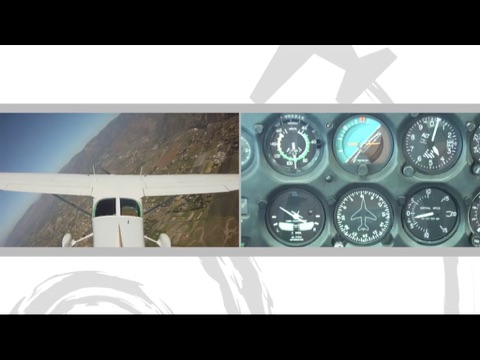
The number of aviation apps available seems to be increasing daily, so pilots are one group of app users who seem to be doing okay when it comes to options. There are games, weather briefings, flight training, charts, and even tracking apps that will keep track of every flight you make. If you're looking for some aviation apps or pilot apps for the iPhone, then check out our awesome list.
The best iPhone apps for pilots
12 May 2021, by Rick Rockwell
The Airliner World Magazine app for iPhone gives you access to Airliner World Magazine by Key Publishing Ltd, the World’s Leading Aviation Publisher. Through this iPhone app for flying you will get Airliner World, which is the largest selling commercial aviation magazine in the world and is a must-read for anyone interested in, or associated with, the industry. For up-to-the-minute news and features on new leases, deliveries, technology, key industry personnel and airport developments from the airline scene, make Airliner World your magazine of choice.
- Industry News and Updates: Reviews and profiles of airlines, airports and aircraft from around the world
- Technology updates: The latest developments from across the commercial aviation industry
- Airliner Classics: Features on bygone aircraft and airlines, along with preservation news
- From the Flightdeck: Experience different aircraft types from the cockpit
- Exclusive interviews: Interviews with key industry players – from airline heads to airport managers
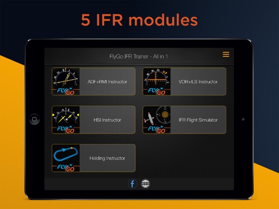
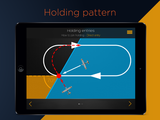
This new generation FlyGo trainer for iPhone brings you all IFR essentials in 1 App: procedure simulator, HSI, RMI, VOR-ILS avionics trainer, holding pattern secrets & more. Flying by instrument flight rules (IFR) is not an easy task for student pilots. With IFR Pack aviation students and pilots will develop and improve their instrument navigation understanding and accuracy. The 'step by step' FlyGo iPhone app for pilots will teach you how to use IFR instruments.
- Automatic Direction Finder (ADF) + Radio Magnetic Indicator (RMI) Instructor
- VHF Omni Directional Range (VOR) + Instrument Landing System (ILS) Instructor
- Horizontal Situation Indicator (HSI) Instructor
- Instrument Flight Rules (IFR) Simulator
- Holding Pattern Instructor
MyFlightbook gives users a tool to enter their flights and track their flying totals and currency. Use of the app requires a free account on MyFlightbook.com and all entered info is stored in the cloud for safekeeping. You'll be able to access your logbook from anywhere, on any device connected to the Internet, and enter new flights or edit existing entries. You'll be able to view flying totals and perform customized searches, look at your flying currency, and view the route of your flight on a map. The app also allows you to find airports nearby and view a list of the airports you have visited.
- Enter flights
- Track flying totals and currency
- Need a free account on MyFlightbook.com
- Access your logbook from anywhere
- Free iPhone apps for pilots
VatMap gives you an online view of the VATSIM Network on your device, which allows you to plan, see, watch, and track VATSIM flights. VatMap plots the online pilots and controllers right on the map on your iPhone. You get in-app charts, a view of all ATC and ATC sectors, and a view of all planes flying online. It's easy to access flight information, information updates every minute, and you can check departures and arrivals. Set your preferred settings, find a controller online, and show yourself and your friends. It's easy to add and delete your friends.
- Track VATSIM data from the cockpit
- See online pilots and air traffic controllers
- View all planes online
- Updates every minute
- Free aviation app for iPhone
dBrief - Pilot logbook was created by a flight instructor and offers fast and easy entry, the ability to explore your currency, the ability to explore your history, and more. You get intelligent route auto-complete suggestions, dynamic keyboard switches between numbers and letters as you type, and you can assign a default aircraft for new flights. You can see a breakdown of your total time and approaches by type for the current month, past six months, and past 12 months. Browse all of your flights in chronological order, go through breakdowns by type or tail number, and perform comprehensive searches.
- Touch any flight time to fill it with the flight duration
- Adds decimal points to flight time as it's entered
- Flight review due date
- Cloud-syncs across devices
- Free iPhone app for pilots
Flight Currency helps you stay on top of whether you're legal to fly as a pilot in command of an aircraft. The app allows you to track your flight review expiration per 14CFR 61.56, medical certificate currency per 14 CFR 61.23, and recent flight experience per 14 CFR 61.57 paragraphs (a through d). The app will figure out expiration dates based on calendar months for medical exams, instrument experience, and flight reviews. If you fly conventional gear aircraft you can mark Tailwheel landings separately. You have the ability to track multiple aircraft currency items.
- Know at a glance if you are legal to fly as a pilot
- Easily track your medical certificate currency, recent flight experience, and flight review expiration
- Mark Tailwheel landings separately
- Track annual and 100 hour inspection
- Know when your registration expires
MyRadar NOAA Weather Radar is a weather app that is fast, easy-to-use, and displays animated weather radars around your location. You'll be able to glance and see what weather is on its way. Start the app and your location will show up with animated weather. The app's high-def Doppler radar data comes from raw NOAA weather radar data from the National Weather Service using proprietary software and systems. You're promised clear, sharp, accurate, up-to-date displays of precipitation and other adverse weather conditions. You can zoom and scroll around the map easily, allowing you to check the weather in other parts of the country.
MyRadar Weather Radar app review
- Fast and easy to use
- Displays animated weather radars
- Custom-designed, proprietary software and systems
- See if rain or snow is in the forecast
- Free with in-app purchases
Zulu Time is a simple app that allows you to see local and Zulu time (GMT) or several time zones with just a glance. This is helpful for pilots in filing flight plans and getting weather briefings. Don't worry about getting the time zone offset incorrect or forgetting about Daylight Saving Time adjustments. It's easy to convert from different time zones, including times in the past or future. The Zulu Time Page lets you see local and Zulu time in the past or future by entering an offset using the Offset button. The Multiple Zones page lets you add as many time zones as you want in a scrolling view.
- See local and Zulu time at a glance
- Use it to file flight plans and get weather briefings
- Don't forget about Daylight Saving Time or time zone offset
- See Zulu and local time in the past or future by entering an offset
- Add as many time zones as you want in a scrolling view
AeroPointer is a worldwide aeronautical dictionary for pilots. It gives you worldwide aeronautic data for more than 41,000 airports and 10,900 radio navigation aids (Navaids). It's designed by the same people who created Nav Trainer and Holding Pattern Trainer so you know it's high-quality. You can see most data even if you have no Internet and other data is cached for later offline view after you access it online. You will be able to see runway info, time zone, local and ICAO identifiers, and notices to airmen for airports. You'll see the type, power output, time zone, and more for Navaids.
- Weather, airport charts and NOTAMs are cached for offline viewing
- Worldwide aeronautic dictionary for pilots
- See most data even when there's no Internet
- See airport data
- See Navaid data
Cloud Topper Pilot Sight Level will allow you to get rid of your sight level because this is an all-new way to determine cloud height designed just for the iPhone and iPad. You'll use your device's gyroscope, camera, and accelerometer as a traditional sight level. You can also enter the distance to a cloud and the app will figure out your height below or above that cloud. The displayed cloud height will even be corrected for the earth's curvature. Note: this app is not approved by the FAA to determine cloud height.
- New method to determine cloud height
- Use your iPhone's accelerometer, camera, and gyroscope
- Enter distance to a cloud and the app will calculate your height below or above the cloud
- Displayed cloud height corrected for earth's curvature
- Not approved by FAA to determine cloud height
AirTrack integrates with multiple data sources and reports flight and navigation data in real time, wirelessly. It was designed to be used with a flight simulator or your iPhone's GPS and a plugin to track your flights in real-time. Turn your car trip into a flight experience: get info about your instant position, surrounding waypoints, and heading. You can also use it as a flight companion to help you plan and monitor your trip. Features include a display of barometric pressure, vertical speed, altitude, and speed; wind speed and direction indicators; and instant GS, MACH, IAS, TAS, and VS when available.
- A full Primary Flight Display with altitude, speed, vertical speed, and barometric pressure
- An MCP panel to control the aircraft's auto-pilot
- Use it with your iPhone's GPS
- Wind speed and direction indicators
- Customizable waypoints
Safelog is one of the most trusted and versatile pilot logbook systems in the world. Tens of thousands of pilots across the globe are using this app and putting their trust in it. Safelog is compatible with the regulations established by many of the aviation authorities worldwide. The app has a polished, reliable interface and user experience. Safelog has many cool and necessary features like efficient flight entry, database of over 70,000 airports, log expenses and income, duty and block time logging, aircraft and contact managers, highly customizable fields, over 100 PDF reports and logbooks printouts, integrated graphs and charts, aeronautical experience analyzers and much more. There’s an in-app purchase required to use this system.
- One of the most trusted and reliable pilot eLogs
- Compatible with worldwide aviation regulations
- Quick and efficient flight entry, Over 70,000 airports listed
- Log expenses and income, over 100 PDF reports and printouts
- Requires in-app purchase of their full services
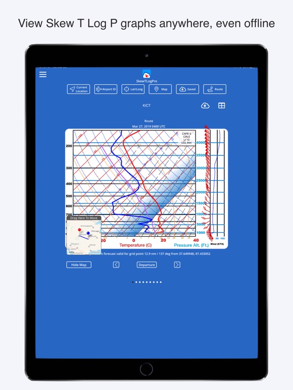
SkewTLogPro gives you access to skew-t-log-p charts. You can see charts using your airport ID code, latitude or longitude, or current GPS location. Each chart offers a visual indication of dew point, temp, wind speed, and winds aloft. Features include the ability to save charts for offline use, one-touch access to charts from anywhere in the U.S., a History list to see previously viewed locations, and the ability to view Skew T Log soundings by touching a location on a map. You can view charts along your route, see information on Canadian airports, scroll forward and back to see forecast and past charts, and you can choose how many past and future hours are charted.
- Touch a location on a map and see Skew T Log soundings
- Use your airport ID, lat/long, or current GPS location
- Support for Canadian airport Ids
- See charts offline
- Data is pulled from NOAA
Aviation Abbreviation Dictionary makes it fast and easy to search abbreviations you need as a pilot. It's great for students as they learn and will aid in understanding. The app displays both the abbreviation and definition in the table view. Data is integrated through the Cloud and you don't need to update to add new abbreviations or fix spelling mistakes. There are over 600 abbreviations. If you know of an abbreviation that isn't listed, contact the developer and it will be added by the end of the day. The app is free but has ads.
- Fast and easy to search abbreviations
- Data integrated through the cloud
- Over 600 abbreviations
- See the abbreviation and definition
- Free with in-app purchase to remove ads
Aviation Exam is an app you can use to prepare for your EASA and FAA pilot theoretical knowledge exams. The app reflects the official question banks, marks questions and sets multiple question flags, gives you two modes of use (Study or Exam), and explanations are provided for all questions. You can see detailed statistics, reports, and your full testing history and you can try five percent of the questions without buying a subscription. There are many free eBooks included in the app like Helicopter Flying Handbook, Risk Management Handbook, and Aviation Weather.
- Free eBooks included
- FAA exams
- EASA (JAA) exams
- Study or practice exams
- Free with in-app subscription
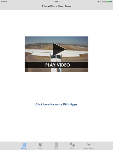
Steep Turns is one portion of the full Private Pilot Course app that you can try before you buy the whole thing. You get 10 minutes of HD videos that show you how to fly steep turns in addition to a copy of the FAA Airplane Flying Handbook and the Private Pilot Practical Test Standards. Take the quiz included in the app after you watch the video and see how much you know. You also get a free Stall Speed and Maneuvering Speed calculator. The full app, which is available for purchase separately, has 2.5 hours of in-flight HD video and detailed animation including all the information you will need to pass your FAA Private Pilot Practical Test.
- Free sample of 10 minutes of HD video
- See how to fly steep turns
- Shows common errors and PTS standards
- Free copy of the FAA Airplane Flying Handbook
- Free app for pilots
ATPL Dictionary has more than 1000 definitions and 900 abbreviations in the full version. Definitions are based on subjects found in the Airline Transport Pilot License syllabus, like Meteorology, Aircraft Performance, VFR Communications, Radio Navigation, Airframes, Air Law, Instrumentation, and Principles of Flight. This app, which is the free trial version, has Word of the Day, Favorites to keep a quick reference for the definitions you use the most, a sharing option, autopilot so the definitions are read aloud to you, and more. The full version has the full list of terms and definitions found in the ATPL Dictionary, iCloud sync, free updates for life, and the ads are removed.
- Full version has over 1000 definitions and more than 9000 abbreviations
- Word of the Day
- Favorites
- Share via Facebook, WhatsApp, and other social media platforms
- Free with in-app purchase to upgrade to full version


